Amid South China Sea Dispute, Philippines’ Palawan Is Besieged by Political Split
All Global Research articles can be read in 27 languages by activating the “Translate Website” drop down menu on the top banner of our home page (Desktop version).
***
Palawan is an outlier in the Philippine archipelago, its topography and habitat closer to that of Borneo than the rest of the country’s major islands. This so-called last ecological frontier is under siege on two fronts: internally, politicians want the island carved up into smaller administrative regions; externally, it stands as a buffer against threats from a superpower across the sea.
On March 13, half a million of Palawan’s population will vote in a plebiscite calling to split up the island into three provinces — north, south, and central Palawan — and leaving its capital, Puerto Princesa, as a separate chartered city, excluded from voting for the province’s future.
The idea, approved by Congress in 2018 and signed by President Rodrigo Duterte a year later, was met by an uproar from environmentalists and settler families who have eschewed the clan-run patronage politics practiced elsewhere in the Philippines. Critics also say the threat of breaking up the island could not have come at a worse time, with the COVID-19 pandemic compounding a maritime dispute with Beijing in the South China Sea.

The proposed divided Palawan will have Palawan del Norte, with Taytay as its capital; Palawan Oriental, with Roxas as its capital; and Palawan del Sur, with Brooke’s Point as the provincial capital. Puerto Princesa City, the existing provincial capital, will become its own chartered city.
The plan to break up the islands has, however, been applauded by political clans who have long pushed for the division; three new provinces create more political positions to farm out.
The group of congresspeople and some local government officials pushing for the division say there is higher revenue to be generated out of this undertaking. They say the split is estimated to yield a 10% increase in each new province’s internal revenue allotment (IRA), the yearly budget handed out by the national government to augment a province’s earnings. In their view, having three administrations instead of one governing the island will kill two birds with one stone: social services will be more accessible and officials will be “closer to the people.”
Opponents of the division warn of a drastic shift in the management of the natural resources Palawan is known for, raising concerns about a possible weakening of the enforcement laws that protect the province’s already threatened ecology.
Whims and wills
The island has come a long way from the penal colony that it once was, to an ecotourism haven; a shift from being a laid-back island province to an international destination for backpackers and jet-setters, famous even by Hollywood standards. For decades, Palawan banked on its natural resources and sustainable practices to provide livelihood for communities and boost its earnings, all heavily hinged on proper environmental management.
The measure being put up for a vote lays out the political structure of a new Palawan region, but remains vague on the implementation of various programs, particularly on environmental management.
Significantly, under the new law the appointment of a Provincial Environment and Natural Resources (PENRO) position is “optional,” and the Palawan Council for Sustainable Development (PCSD), the current overseer of environmental regulations, will have to have three officials as de facto heads of the council, a prospect that might stymie or create delays in decision-making.
With the environment a devolved sector in Philippine governance, groups say the unclear management structure will depend on political whims and wills, as it is municipalities, after all, that fund the hiring of forest and marine guards.
The possible rise in revenue also isn’t what it seems, says Ferdie Blanco, a strategic planning specialist and part of the ONE Palawan movement opposing the island’s partition. Palawan remains heavily dependent on the IRA from the national government, and the state of infrastructure and basic services remains inadequate, he said. So why break it up when development should be the focus, he asks.

The proposed conservation zone for the Victoria-Anepahan mountain range, home to the Philippine pangolin (Manis culionensis) sees heavy deforestation in recent years. Image created through Global Forest Watch
And while the island may obtain wealth in terms of extractive industry, proceeds from large-scale mining in the south and gas field exploration in the north will be distributed separately to the three provincial governments if the law is passed.
Under current laws, municipalities and barangays (villages) affected by large-scale extractive projects earn through a revenue-sharing scheme with the national government. In the revenue allotted for local governments, municipalities and barangays are entitled 35% and 45% each of the revenue generated by these industries, leaving 20% for provincial offices. But the new law will overturn this: provincial governments stand to gain 60%, cutting down the shares of municipalities to 24% and barangays, the smallest political units in the country, to 16%.
“A community that hosts a mining site should have the biggest share because they are directly affected by these projects,” Blanco says. “But the division law reverses this … This allocation is far from equitable.”
He compares the economic performances of other provinces that have been split into smaller units and cites two trends: Divided provinces reported higher poverty rates, and one province becomes a “laggard,” left behind in terms of progress. In Palawan, Blanco says this is likely to be the middle part of the island, which would be called Palawan Oriental and where a majority of residents depend on low-income fishing and agriculture.

Frozen Philippine Pangolins intended for the wild meat black market were seized in Palawan on 28th July 2018. Image by TRAFFIC.
While the province is on the front lines of conservation in the country, with its protected areas regarded as model initiatives, Palawan also suffers from a wide range of destructive activity, from poaching to wildlife trafficking, largely due to the fact that it does not have enough enforcers, and, often, political will to crack down on the illegal trades.
Palawan is considered the “hottest hotspot” in the Philippines’ wildlife trafficking routes, according to USAID’s Protect Wildlife project, also citing intelligence reports showing the involvement of “influential people that maintain a network of perpetrators.”
The island is home to more than 400 wildlife species, most of them found nowhere else on Earth. The island likewise boasts of having one-eighteenth of the world’s biodiversity, says Aldrin Mallari of the Center for Conservation Innovations.
“The current conservation policies do not match the needs of the threatened species,” says Mallari, adding that if the status quo remains and if the island winds up divided, it will be “the last nail on the coffin” for the future of Palawan.
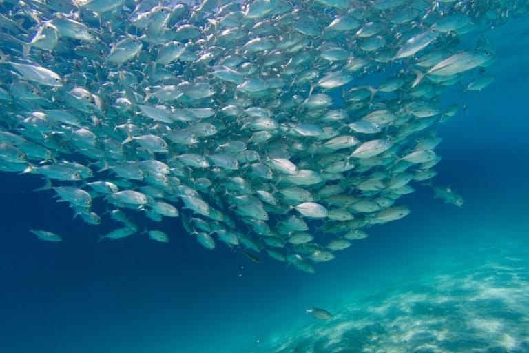
A school of juvenile bigeye trevally (Caranx sexfasciatus ) swims in the shallows of Dimakya Island, Palawan, Philippines. Image by Steve De Neef/Greenpeace
Around 36% of the country’s marine species comes from the waters off the island’s 2,000-kilometer (1,240-mile) coastline, says Oceana Philippines, a conservation NGO. Fisheries statistics show Palawan is the top province in terms of fish volume production, valued at 14 million pesos ($288,000) in 2019 – a huge amount for fishers who are considered among the poorest in the country.
Palawan, too, has the largest forest cover of any province in the Philippines, but every year it loses an average of 13,323 hectares (32,922 acres) to mostly illegal logging that takes place on the range of Mount Mantalingahan — one the island province’s largest protected areas. If the new measure to split up the province succeeds, the protection of the mountain will fall under the sole jurisdiction of what will be called Palawan del Sur province in the south.
Central Palawan covers the Victoria-Anepahan mountain range, home of the critically endangered Philippine pangolin (Manis culionensis), a scaly anteater that’s become increasingly rare to spot in the wild due to poaching and wildlife trafficking. Municipal authorities are still in the long process of crafting a “harmonized management system” among the local government units — already a challenge under a single province, and expected to become more complicated under three.
As the plebiscite nears, the people are just as divided, with the northerners generally against breaking up the province, while those in the south, which has already seen profits from mining and the prospects of oil palm plantations on Indigenous lands, are said to favor it.
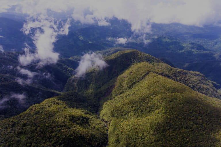
Mt. Mantalingahan Protected Landscape is Palawan’s largest terrestrial protected area that serves as home to 2,951 Indigenous families. Image courtesy of MMPL Protected Area Office
Dynastic politics
Governor Jose Alvarez, the prime mover behind the split, has painted a picture of northern Palawan sticking to the business of tourism, and southern Palawan being turned into a grand economic zone.
Alvarez, who hails from Mindanao in the southern Philippines, has risen to political power through the years since he first established his presence as one of the biggest logging concessionaires on the island. In the early 1990s, his business took a hit when a nationwide logging ban was imposed and Palawan was put under the scope of a strategic environmental plan.
He stayed, funding advocacy projects and programs across municipalities and eventually running for office in 2010. He failed on his first attempt, but won by a landslide in 2013, remaining in office for three consecutive terms, the maximum allowed. His support for splitting up the province is a common tactic for political clans seeking to expand their domain; the splitting of other Philippine provinces has allowed the ruling dynasties there to continue occupying congressional and local government seats.

Governor Jose Alvarez solicits local officials’ support on RA 11259 in a Palawan Oriental baranggay summit last March 2020. Photo courtesy of Provincial Government Office via 3n1 Palawan Facebook Page
Governor Alvarez’s plan, seen through this lens, will likely benefit his family links and loyal allies; his relatives hold pivotal posts in Palawan province. But in the current geopolitical climate, Palawan stands as a sentinel in what the government calls the West Philippine Sea, and its place on the map has become critical.
Environmentalists are wary of Alvarez’s designs, saying his plan of dividing Palawan is one driven by a political agenda and done without consultation with civil society and other special interest groups.
The governor has, for example, already pushed for the exemption of specific protected areas from the Expanded National Integrated Protected Areas System (E-NIPAS). He said it would restrict development projects in those areas; but just before the pandemic lockdown in early 2020, the province passed an ordinance creating a new council to oversee the management of all of Palawan’s protected areas.
Bordering disputed waters
The capital, Puerto Princesa, has seen drastic changes over the past few decades. Once a sleepy town, its commercial boom has shaken up environmental rules. A highway built in 2007 that runs from the city to the north, where tourism flourishes, has sped up the rate of business, but failed to regulate a mushrooming tourism industry that has largely broken the principles of conservation.
The capital itself has turned into a crowded urban center where a growing number of tour groups from mainland China have caused friction with the local population. There are fears the situation could get worse as foreign tour operators try to monopolize the business in what the locals call “an invasion.”
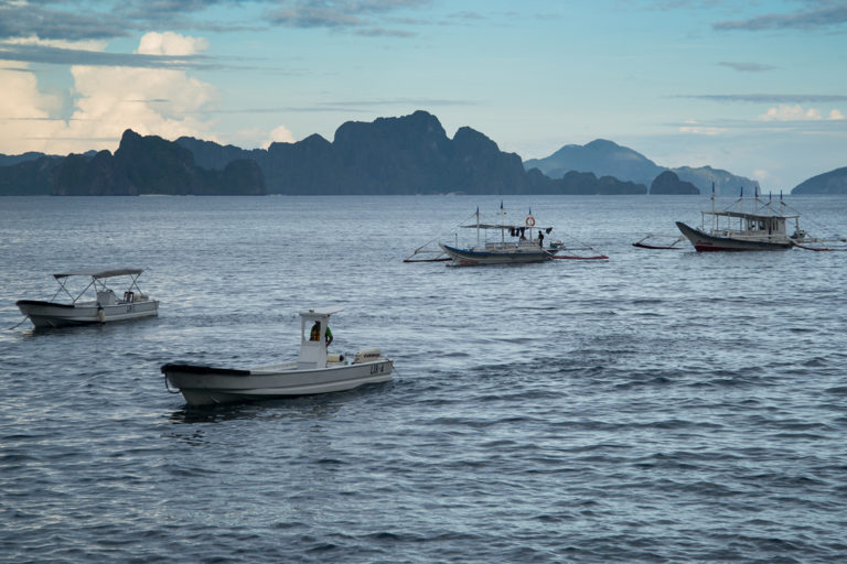
Local Philippine fishers’ boats in Palawan. Fisheries statistics show Palawan is the top province in terms of fish volume production. Image courtesy of John Griffiths via Flickr (CC 2.0).
In late 2019, a scandal erupted when a military raid on an apartment unearthed a huge cache of dried pangolin scales, seahorses and marine turtle carapace for smuggling. The foiled smuggling attempt allegedly involved a Chinese businessman previously involved in wildlife trafficking and suspected of smuggling in Chinese nationals working for online gambling operations.
The past six months saw an uptick in the poaching of giant clams with authorities seizing at least 150 tons of fossilized shells buried in the sand across various areas in the province. Seen as a replacement for ivory, Palawan’s giant clams have been the target of Chinese poachers.
More than anything, Palawan is now on the front line of geopolitical tension in the South China Sea, bracing itself for any possibility of a flashpoint. Its southern coastline is a jumping-off point to Thitu Island, otherwise known as the Kalayaan Island Group, occupied by the Philippines to mark its territory among the tiny islands, shoals and reefs that China says falls within its own “nine-dash line” — a controversial maritime border Beijing wields to lay claim over the vast expanse of the South China Sea.
For the past five years, the presence of foreign vessels within what the Philippines considers its maritime areas has increased. The country’s fisheries bureau has classified Palawan’s western coast as a fisheries management area, within it the country’s exclusive economic zone (EEZ) in portions of the Spratly Islands identified as part of the Philippines’ continental shelf by The Hague ruling — areas mostly occupied by the Chinese military and its newly built bases.

Map of the Spratly Islands in the South China Sea by the U.S. Department of State (2015), showing occupation by Vietnam, China, Taiwan, Malaysia, Philippines. Image via Wikimedia Commons, Public Domain
Heat maps based on a technology called visible infrared imaging radiometer suite (VIIRS) show that the majority of boats roaming in this area are foreign fleets: if a boat has lighting equipment powerful enough to be picked up by VIIRS, it is almost certainly a large vessel or part of a major fishing fleet rather than belonging to an artisanal fisher.
In the Kalayaan island group, VIIRS detected about 59,000 boats in 2016. But foreign intrusion in the country’s western coast in 2019 went up to almost 133,000 boat detections. These figures, monitored by sources who do not wish to be named, reveal how much of poaching, commercial fishing legal or otherwise, or military patrolling have taken over the island’s spawning ground.
There have been reports of boats identified as those coming from Malaysia, Indonesia, Vietnam, Taiwan, and China — countries that also stake a claim to portions of the South China Sea — as well as from Japan, which appears to be more interested in catching tuna. The heat signatures, which appear as dots on a map, also significantly picked up the lights that were monitored pointed to Chinese vessels.
Such incursions have cost the Philippines billions of pesos in losses of its natural resources, something the Constitution says should be protected. Palawan alone has been unable to stop these, and with issues of national security, it is even more helpless, especially since President Duterte made a U-turn in Philippine foreign policy and started an open-arms policy with China when he was elected in 2016.
“We don’t want to go to war,” Duterte said repeatedly in various public speeches, casting aside incidents of Chinese fleets sinking the boats of artisanal fishers as “accidents” and downplaying reports of community fishers going hungry for being deprived access to the high seas.
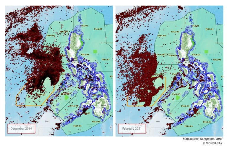
Heat maps based on VIIRS technology show boat detections in the South China Sea. Map accessed through Karagatan Patrol
With the pandemic forcing the economy into a recession, the Philippines, like its neighbors in Southeast Asia, has turned to Beijing to aid its recovery despite growing local sentiments against China. Last October, Duterte lifted a six-year moratorium on mineral exploration in the South China Sea, potentially reopening a shuttered natural gas drilling deal between the Philippines, China and Vietnam.
What this coming plebiscite in Palawan might boil down to is a choice between cohesion and division. Palawan has had much to deal with in the past two decades; through those years it tried to keep its reputation of being the last frontier.
With the division, the task of protecting Palawan’s and the country’s maritime borders, already beset by politicking and resource limitations, will add more layers of jurisdiction and could potentially complicate coordination processes, groups say. Those against the law prefer the island together — to keep it from falling apart.
*
Note to readers: please click the share buttons above or below. Forward this article to your email lists. Crosspost on your blog site, internet forums. etc.
Criselda Yabes is a prize-winning journalist and book author. Her latest book, The Battle of Marawi, explores the military strategies that brought an ISIS-inspired faction to its knees.
Leilani Chavez is Mongabay’s staff writer in the Philippines.
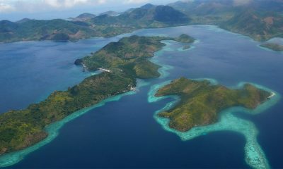
Featured image: Islands of Coron in northern Palawan, Philippines, April 2008. Image by Patrick Kranzlmüller via Flickr (CC BY-NC-ND 2.0)

